Current Activation Level
Safety Messages
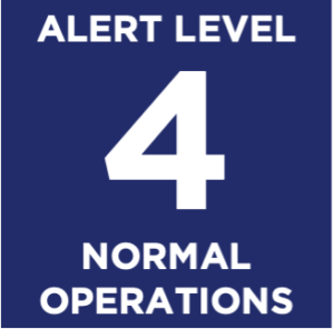
- June 18, 2026, (Houston). The TGCRVOAD is returning to Level 4, NORMAL OPERATIONS. No significant unmet needs were reported.
Situation Brief
The remnants of Post-Tropical Storm Arthur have weakened into an elongated trough over southeast Texas and southwest Louisiana and will continue moving northeast across the Southeast, producing dangerous flooding rains from Louisiana to the Florida Panhandle and Georgia.
A Heat Advisory is in effect from 11 AM Thursday through 10 PM Friday. High Temps: 90°-95°F / 32°-35°C Heat Index: 107°-114°F / 41°-46°C If you have AC, use it. Fans may not be adequate. Limit strenuous time outdoors in the afternoon. Stay hydrated. Wear light-weight, light-colored clothing.
Activation Levels
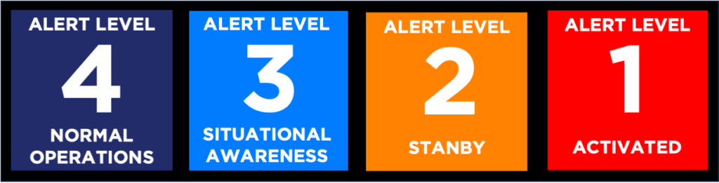
TXGCRVOAD uses Activation Levels to communicate a shared understanding of our activities. Level 4 denotes Normal Operations, and levels 3 through 1 indicate that TGCRVOAD is in some disaster response/short-term phase. Note that the TGCRVOAD may be operating on several levels at a time. For example, we could be Level 3 – monitoring a potential threat in the Gulf of Mexico that may be a week away; Level 2 – standing by to respond to a threat to Matagorda County that is imminent; Level 1 – responding to a wildfire in Montgomery County, and transitioning responsibility to the local LTRC for a tornado a month ago in Fort Bend County.
TGCRVOAD Activation Levels
- Level 4 NORMAL OPERATIONS
- Level 3 SITUATIONAL AWARENESS
TGCRVOAD: Monitors the threat and identifies the need to escalate the activation level
VOAD Members and Partners: Monitor the threat - Level 2 STANDBY
TGCRVOAD: Monitors VOAD activity and assists with coordination activities
VOAD Members and Partners: Stage resources and prepare to respond quickly as Requests for Assistance (RFAs) are made - Level 1 ACTIVATED
TGCRVOAD: Conducts Coordination Conference Calls – Situation Reports (SitReps) and Coordination; Coordination with VOADS, Long-Term Recovery Committees (LTRCs), and Offices of Emergency Management (OEMs).
VOAD Members and Partners: Provide periodic Situation Reports (SitReps) and participate in Coordination Conference Calls - LEVEL 1 ACTIVATED – transition to LTRC
TGCRVOAD: Coordinates Activities of VOAD Members and Partners and Long-Term Recovery Committees (LTRCs); Supports LTRCs
VOAD Members and Partners: Ensure clean handoff to LTRCs; Support LTRCs
For more information, see Functions in Disaster