Current Activation Level
September 3, 2026, (Houston).
TS Edouard made landfall near Johnson Bayou, Louisiana — about 15 miles southeast of Port Arthur, Texas — Tuesday afternoon, September 1, with 60 mph sustained winds and a gust to 71 mph recorded at Texas Point. It weakened as it tracked northwest across Beaumont and deeper into Texas, reaching tropical depression strength that night. By this morning’s final NHC advisory at 4:00 AM CDT, its remnants were a 25 mph low near 40 miles southeast of Dallas, expected to dissipate within 24 hours. Rainfall was the storm’s dominant hazard throughout, with storm-total accumulations of 5–10 inches along its inland path and localized maxima up to 22 inches. Flood watches remained active across much of East Texas, and flash flood and isolated major river-flooding risks stayed elevated even as the wind threat faded.
Among the hardest-hit counties in early iSTAT reporting were Jefferson, Orange, and Hardin. However, the heaviest rains were to the north, in Polk, Newton, Jasper, Angelina, and Liberty counties. Many counties are expected to submit additional reports as waters recede. We are thankful the Edouard steered clear of more populated areas. The SE Texas VOAD is holding Coordination Calls, and we will amplify any calls for assistance for our Southeast Texas neighbors.
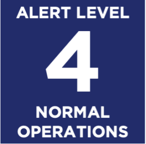
TGCR VOAD will … return to normal operations
MEMBERS should … return to normal operations
Activation Levels
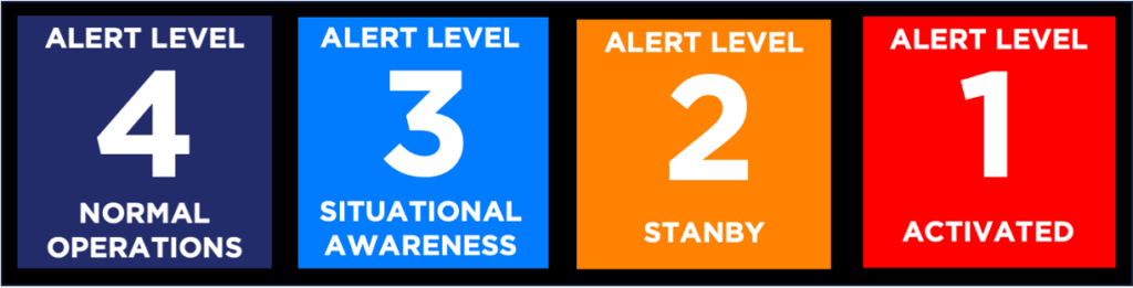
TXGCRVOAD uses Activation Levels to communicate a shared understanding of our activities. Level 4 denotes Normal Operations, and levels 3 through 1 indicate that TGCRVOAD is in some disaster response/short-term phase. Note that the TGCRVOAD may be operating on several levels at a time. For example, we could be Level 3 – monitoring a potential threat in the Gulf of Mexico that may be a week away; Level 2 – standing by to respond to a threat to Matagorda County that is imminent; Level 1 – responding to a wildfire in Montgomery County, and transitioning responsibility to the local LTRC for a tornado a month ago in Fort Bend County.
TGCRVOAD Activation Levels
- Level 4 NORMAL OPERATIONS
- Level 3 SITUATIONAL AWARENESS
TGCRVOAD: Monitors the threat and identifies the need to escalate the activation level
VOAD Members and Partners: Monitor the threat - Level 2 STANDBY
TGCRVOAD: Monitors VOAD activity and assists with coordination activities
VOAD Members and Partners: Stage resources and prepare to respond quickly as Requests for Assistance (RFAs) are made - Level 1 ACTIVATED
TGCRVOAD: Conducts Coordination Conference Calls – Situation Reports (SitReps) and Coordination; Coordination with VOADS, Long-Term Recovery Committees (LTRCs), and Offices of Emergency Management (OEMs).
VOAD Members and Partners: Provide periodic Situation Reports (SitReps) and participate in Coordination Conference Calls - LEVEL 1 ACTIVATED – transition to LTRC
TGCRVOAD: Coordinates Activities of VOAD Members and Partners and Long-Term Recovery Committees (LTRCs); Supports LTRCs
VOAD Members and Partners: Ensure clean handoff to LTRCs; Support LTRCs
For more information, see Functions in Disaster